ZenaTech Opens Orlando Drone-as-a-Service Location, Targeting Government Surveying and Mapping Work Starting April
New operational unit added inside Orlando-area headquarters
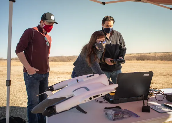
ZenaTech Inc., a publicly traded technology company that markets drone-enabled surveying and mapping services, said it has opened a new Drone as a Service (DaaS) operating location within its Orlando-area headquarters facility. The company described the Orlando site as its 23rd DaaS location globally and positioned it as a hub aimed at public-sector customers, including federal, state, county, and municipal agencies.
The Orlando DaaS location is planned to support surveying and mapping work connected to defense installations, energy infrastructure, and transportation projects. The company stated that the local unit will coordinate with its Washington, D.C.-area business development presence as it seeks government and defense-related work.
Staffing and timeline for ramp-up
ZenaTech said the Orlando DaaS location is being staffed with a 10-person team, including drone pilots, land survey technicians, and business development personnel. The company reported it is in the process of hiring and equipping the operation, including setting up drones and vehicles, with full operations expected to begin in early April 2026.
In a prior corporate announcement, the company had already identified Orlando as the headquarters city for its DaaS business and indicated it was securing a 20,000-square-foot office facility intended to function as an operational hub for national activities while also serving the Southeast region.
How drone surveying fits into the government market
Drone-based surveying and mapping has become a specialized segment of infrastructure and public-works support, providing aerial data capture that can be used for topographic mapping, site documentation, and inspection workflows. Government procurement in this area typically emphasizes mission requirements, operator qualifications, and information security controls.
In the United States, commercial drone operations generally fall under Federal Aviation Administration rules for small unmanned aircraft systems. FAA guidance for Part 107 operations requires remote pilots to hold a Remote Pilot Certificate and to keep training current on a recurring schedule.
- Planned focus areas: defense-related surveying and mapping, transportation corridors, and energy infrastructure projects
- Initial staffing plan: 10-person team including pilots, survey technicians, and business development staff
- Operational target date: early April 2026, following hiring and equipment setup
Security certifications highlighted for future work
ZenaTech said that, in the short term, its Orlando hub intends to perform survey and mapping work for defense-sector customers using traditional survey methods while it builds drone integration and works toward certifications referenced as Green UAS and Blue UAS. These programs are commonly associated with cybersecurity and supply-chain vetting expectations used in sensitive government and defense environments.
The company characterized the Orlando operation as a strategic hub designed to pursue public-sector surveying and mapping opportunities and expand its government-facing presence.
The announcement adds to a series of company moves in Florida and the Southeast, where ZenaTech has been building a regional footprint through a combination of new service rollouts and acquisitions of surveying and inspection businesses.