Historic Central Florida Flurries: A Verified Timeline of Rare Sleet and Snow Reports Since 1977
Why wintry precipitation is rare in Central Florida
Central Florida’s climate makes snow accumulation exceptionally uncommon. Even when strong Arctic air reaches the peninsula, temperatures near the ground often hover close to freezing and the cold layer can be shallow. That combination favors brief, mixed precipitation—such as sleet (ice pellets) or flurries—rather than sustained snowfall. As a result, the region’s most notable events are typically reported as short-lived episodes, often with little or no measurable accumulation in the Orlando metro area.
Key verified events: 1977 to 2022
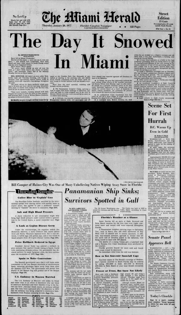
January 1977: Reports of snow flurries and sleet were documented across Central Florida, including the Orlando area. This episode is widely cited as the earliest modern-era benchmark for wintry precipitation reports in the region.
December 1989: Two days before Christmas, a winter storm affected the eastern United States. In Central Florida, observers reported snow flurries and ice pellets in and around Orlando, while heavier impacts were concentrated farther north.
January 2003: Ocean-effect snow was reported along Florida’s Atlantic coast from Flagler Beach to Fort Pierce. Reports extended inland to eastern Orange County, highlighting how very cold air moving over comparatively warm ocean waters can generate narrow bands of wintry precipitation.
November 2006: A late-season system produced light wintry precipitation reports in Central Florida. Snow flurries were reported in Orange, Seminole, and Volusia counties—an unusual timing for the region, given Florida’s typically mild Novembers.
January 2010: Sleet was observed across parts of Central Florida, including reports spanning from Poinciana to Palm Bay. Traces of snow were also reported in the Orlando area during the event.
December 25, 2022: Sleet was confirmed in parts of Brevard County, including communities such as Rockledge, Cape Canaveral, and Port St. John. The event occurred during a widespread holiday cold outbreak, when sub-freezing temperatures and precipitation overlapped.
How these events are typically recorded
Local wintry episodes in Central Florida are often documented as “trace” occurrences or observer reports rather than measurable snowfall. In practice, “flurries” can be visible without accumulation, while sleet may briefly coat elevated or colder surfaces—cars, roofs, or outdoor furniture—before melting. Differences in elevation, proximity to the coast, and the exact temperature profile above ground can determine whether precipitation arrives as rain, sleet, or snow.
In Central Florida, the most historically significant winter-weather moments have generally been short-duration reports of sleet or flurries, not sustained, accumulating snowfall.
What the timeline shows
From 1977 through 2022, confirmed or widely documented Central Florida events form a pattern: the region’s rare wintry precipitation tends to occur during sharp cold intrusions, sometimes enhanced near the Atlantic coast by ocean-effect processes. For Orlando and surrounding counties, these episodes remain notable precisely because they are infrequent—and because the region’s typical winter conditions rarely align to support lasting snow on the ground.